Hiking near Alcantarilla
12 routesMurcia
12 marked hiking routes start within 10 km of Alcantarilla, from 1.7 km to 17.1 km long. 0 of them reach above 1,500 m.
The routes are sorted by distance from the town centre. Each route page has its own danger layers with sources and dates.
Use at your own risk
Information only. Conditions change, the data can be wrong, and you are responsible for your own safety. Check the official bulletins on the day, tell someone your route and call 112 in an emergency.
Read the full notice
Routes near Alcantarilla
Sendero de las Brujas (PR-MU 29)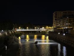 Camina 10000 Pasos (SL-MU 10)
17.1 km4 h 35 min100 m upHard (est.)
Veteranos 92 (PR-MU 21)11.7 km4 h 05 min575 m upModerate (est.)
Camina 10000 Pasos (SL-MU 10)6.8 km1 h 45 min15 m upEasy (est.)
Castillo del Puerto de la Cadena (PR-MU 54)2.1 km1 h 15 min295 m upEasy (est.)
Barranco Blanco (PR-MU 52)6.8 km2 h 15 min190 m upEasy (est.)
Umbrías de Santo Ángel (PR-MU 22)3.2 km1 h 40 min370 m upEasy (est.)
Variante Veteranos 92 (PR-MU 21.1)1.7 km0 h 40 min125 m upEasy (est.)
Camino de los Arejos (PR-MU 34)4.0 km1 h 30 min295 m upEasy (est.)
Variante Camino de los Arejos (PR-MU 34.1)3.8 km1 h 30 min290 m upEasy (est.)
Variante Umbrías de Santo Ángel (PR-MU 22.1)3.9 km1 h 50 min410 m upEasy (est.)
Barranco de los Cañones (PR-MU 53)3.7 km1 h 10 min40 m upEasy (est.)
Cuevas del Buitre (PR-MU 35)3.0 km1 h 05 min75 m upEasy (est.)