Hiking in Segovia
10 routes11.6 km longest2 above 1,500 m
Segovia has 10 hiking routes in this guide, from 3.9 km to 11.6 km long. 2 of them reach above 1,500 m and 0 are graded hard by this app. No route here crosses a mapped flood zone, but the map covers only the river stretches the ministry has studied. The longest is Senda del Río (PR-SG 6), at 11.6 km.
Heat, snow and avalanche notes depend on the height and place of each route, so they are on the route pages.
Use at your own risk
Information only. Conditions change, the data can be wrong, and you are responsible for your own safety. Check the official bulletins on the day, tell someone your route and call 112 in an emergency.
Read the full notice
Routes in Segovia
Usual walking months come from a rule of thumb about heat and snow. They are not a safety rating.
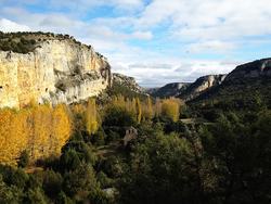 Senda de la Ermita del Casuar (PRC-SG 7)
10.2 km3 h 30 min360 m upModerate (est.)
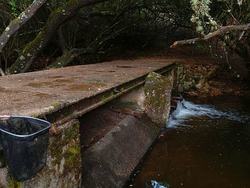 Senda del Acueducto
3.9 km1 h 10 min130 m upEasy (est.)
Senda del Río (PR-SG 6)11.6 km3 h 25 min150 m upModerate (est.)
De Melque a Laguna Rodrigo10.4 km2 h 45 min75 m upModerate (est.)
Alamos Blancos (SL-M 44002)7.1 km2 h 20 min215 m upModerate (est.)
Pasaderas - Pesquerías6.2 km1 h 50 min95 m upEasy (est.)
Camino de Peguerinos5.8 km2 h315 m upEasy (est.)
Sendero del Paredón de San Félix (PR-SG 12)5.7 km1 h 40 min100 m upEasy (est.)
Senda de las Tenadas de Valdevacas (PRC-SG 9)4.4 km1 h 20 min100 m upEasy (est.)
Embalse de Linares del Arroyo (PRC-SG 10)4.0 km1 h 10 min55 m upEasy (est.)